


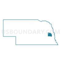
Wahoo W1 Voting District, Saunders County, Nebraska
About
Outline

Summary
| Unique Area Identifier | 613891 |
| Name | Wahoo W1 Voting District |
| County | Saunders County |
| State | Nebraska |
| Area (square miles) | 0.58 |
| Land Area (square miles) | 0.58 |
| Water Area (square miles) | 0.00 |
| % of Land Area | 100.00 |
| % of Water Area | 0.00 |
| Latitude of the Internal Point | 41.22054050 |
| Longtitude of the Internal Point | -96.62663140 |
Maps


Graphs
Select a template below for downloading or customizing gragh for Wahoo W1 Voting District, Saunders County, Nebraska


Neighbors
Neighoring Voting District (by Name) Neighboring Voting District on the Map
- Center Precinct, Saunders County, NE
- Wahoo Rural Precinct, Saunders County, NE
- Wahoo W2 Voting District, Saunders County, NE
- Wahoo W3 Voting District, Saunders County, NE
Top 10 Neighboring County Subdivision (by Population) Neighboring County Subdivision on the Map
- Wahoo city, Saunders County, NE (4,508)
- Center township, Saunders County, NE (628)
- Stocking township, Saunders County, NE (453)